GR 204. Cycling and pedestrian coastal path. Section 1: Bustio – Pendueles

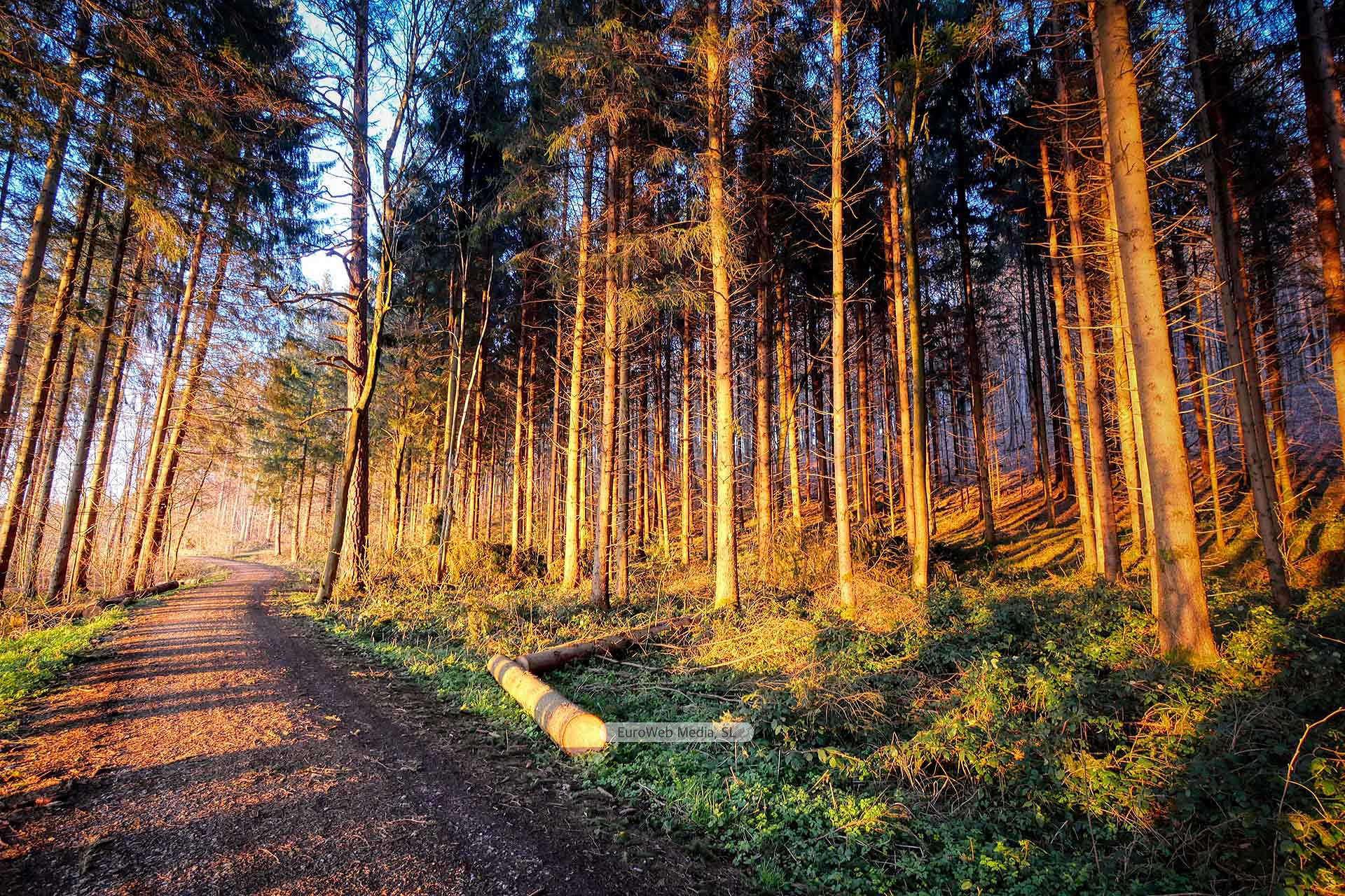
Note: The photo we show of GR 204. Coastal path for bicycles and pedestrians. Section 1: Bustio – Pendueles is for illustrative purposes only. If you notice any errors in the content, please use the form at the bottom of the page.

Description:

Description of the path

The route begins in the Parque de la Remansona (Bustio), and continues, once the N-634 has been crossed through an existing internal passage, along a gravel track 3.50 m wide, going through the neighborhoods of La Texera and Salcea, in a length of 1,500 m, until connecting with a royal road that will lead to Pimiango. The signaling, placed every 1,000 meters per kilometer, and at intersections and deviations the directional, will accompany the entire layout to avoid doubts for users.

As a site of interest, it is worth noting the existence of the Bustio Fishing Port in the vicinity of the beginning of the path, if we follow the congested road once we have crossed the N-634.

From that point of intersection, we will have the opportunity to see the Ruins of the Tina Monastery and the Hermitage of San Emeterio. To do this, we will take the existing gravel path that crosses the Eria Nueva, and after going downhill through the eucalyptus forest in the Tina area, we will come to the ruins of the Tina Monastery, an old construction that still remains on its walls (see information sign).

From there we will cross the Bartolo stream, through a footbridge in treated laminated wood, and continuing the path, we will border the Monte las Gurizas, to end at the road to the San Emeterio Lighthouse, from where you can reach the Hermitage of San Emeterio and to the recreational area of El Pindal, to discover the prehistoric Pindal Caves and enjoy some very beautiful panoramic views of Ensenada Moral.

Joining the road to El Faro de San Emeterio, we will arrive at the Mirador del Picu de Pimiango, from where the path will take us directly to the center of Pimiango from where we will have wonderful views to the left (pre-coastal valley at the foot of Cuera and in the background the Picos de Europa), and to the right (coastal level and the sea horizon).

We leave Pimiango by the local road RD-1, crossing over the FEVE road (Oviedo – Santander).

We continue on our way until we cross the N-634, after which we will turn right. We continue along the paved road and pass in front of the Chapel of El Cristo, and then turn left onto the RD-3.

We will continue along it until its conclusion, passing in front of the El Mirador del Llavandes campsite. It is then that we come to a path that, crossing in front of the L’Aixu stables, and crossing the Serra and Tejavana landscapes, leads us to a paved road that ends at La Franca.

Before reaching the N-634 and without crossing it, we will join the path that goes to Tresgrandas, to travel on it for about 1,500 m., and leave it when we find a gravel path that takes us to an area known as La Peña.

After crossing the river Cabra (through a bridge that is a historical monument and coincides with the Route of the Camino de Santiago), we take the road that goes up to the Sierra Plana de la Borbolla, up to the local road LLN-4, where we will turn right to get to Buelna, crossing the places of Tobiu and Llavadero.

Once in Buelna, after going through its streets in the direction of the coast, and once again crossing the FEVE line, we will find the well-differentiated gravel path that will lead us to Pendueles.

Once in Pendueles we have covered a total of 21,600 m of coastal path.

Asturias, with the family

Note: The photo that we show of Asturias, with the family is only for illustrative purposes. If you notice any errors in the content, please use the form at the bottom of the page.

Description:

From east to west and from north to south, Asturias is a large-scale theme park, ideal to enjoy at any age and, of course, with the family.

  • Ruta en coche: 414,5 km
  • Approximate duration: 5 days

Asturias, with the family

The richness of the landscape and the cities and the wide variety of activities and facilities available in Asturias make the region a large-scale theme park to enjoy at any age, an ideal destination to enjoy with the family.

  • DAY 1: Colombres – Lastres
  • DAY 2: Lastres – Oviedo
  • DAY 3: Oviedo – Gijón
  • DAY 4: Gijón – Navelgas
  • DAY 5: Navelgas – Figueras

DAY 1: 89 km – Colombres – Lastres

The route begins at the eastern end, at Quinta Guadalupe (Colombres), home to the Indianos Archive.

This space shows the emigration of several generations and is surrounded by an extensive green area to enjoy the visit.

En el camino hacia el centro de la región, en Llanes, hay otras dos opciones ideales para disfrutar en familia.

You can discover the inland beach of Gulpiyuri, near Naves.

Gulpiyuri is a sandy area located 100 meters from the coast, with pedestrian access.

Or if you prefer to combine nature and mythology, then the best choice is El Camín Encantau, in the Ardisana valley, which is connected by mythological wood carvings.

The starting point of the path is in Venta del Pobre, which is accessed from Posada de Llanes via the AS-115.

Those who prefer contact with nature but less physical activity can visit the La Grandera Nature Park, a zoo dedicated to environmental education.

The route continues along the Cantábrico Highway (A-8), towards Colunga.

A few kilometers from Lastres, on a privileged watchtower, is an essential: the Jurassic Museum.

Shaped like a dinosaur footprint, it shows the history of these prehistoric giants, some of which can be seen in life size.

DAY 2: 86,9 km – Lastres – Oviedo

The Cabranes Rural School Museum allows you to start the day in the classroom and show the little ones what a class was like just a few decades ago.

This center is located in Viñón, a town that is accessed by the AS-255, which connects Villaviciosa and Infiesto.

In the council of Bimenes, there is another alternative with history, the Radio Museum.

Located in Suares, it is made up of 340 pieces such as microphones, radios and jukeboxes, elements that until not long ago were very useful but today look like antiques.

This equipment is accessed by the AS-251 road, from Nava.

The rest of the day can be arranged in Oviedo.

Families can discover the Pre-Romanesque Interpretation Center, in Naranco, the Archaeological Museum, in the center, with a multitude of interactive elements, the Winter Park or the La Manjoya Nature Classroom, which can be reached by foot, through a pedestrian path.

Or they can also go to El Bosque, a natural area with 170 animals, located in Los Molinos.

DAY 3: 30,1 km – Oviedo – Gijón

The third day has its epicenter in Gijón.

The Talasoponiente center is a recreational-aquatic complex located on Poniente beach, with a children’s area and a heated outdoor pool.

Without leaving the marine environment and a very short distance away, is the Aquarium, which offers its visitors a journey through the seas of the world.

You can skate in Poniente or walk and cycle along the Paseo del Muro de San Lorenzo.

This route continues towards the rural area.

Two other options are the Railway Museum, in the center, or the Atlantic Botanical Garden, which can be reached by public transport from the center.

For children under 12 years of age, the visit is free.

DAY 4: 122,5 km – Gijón – Navelgas

On this day we return to the rural world.

Thus, from Gijón, on the A8 to Soto del Barco where we will turn off on the AS-16, we arrive at Cornellana.

From the Salmón river park, in La Rodriga, an ideal route to do with the family starts, along the banks of the Narcea river.

A few kilometers along the national N-634, is Salas and its crenellated tower, from the 16th century.

The trip continues in Tineo, where two options open up.

Navelgas and its Gold Museum, allow to become familiar with the extraction of the material and also with the tamping in the rivers to extract the remains.

For its part, in El Arenero, an intensive fishing preserve located 3 kilometers from the capital of Tiné, you can spend a day fishing or enjoy yourself in the recreational area and take routes on foot or by bicycle.

DAY 5: 86 km – Navelgas – Figueras

The last day is reserved for an incursion to the West.

Known as Villa Blanca, that is, Luarca, is one of the most outstanding seafaring enclaves on the Asturian coast, due to its beauty: its historic quarter, its bridges, its beaches, its port with numerous taverns and restaurants serving good seafood, its cemetery with excellent views of the sea, the lighthouse, the table for seafarers, the town of Villar —birthplace of the Nobel Prize in Medicine Severo Ochoa—, etc., are more than an excuse for a stop in the capital of Valdés.

The next one, following the A-8, is in Coaña, in the town of Villacondide.

In this small nucleus, there is one of the best preserved castros, an ancient town that was inhabited several centuries before the Roman conquest.

The Eo estuary is the final destination point of the trip.

At its mouth you can practice a multitude of water activities.

The quietest, ideal for sharing with the family, is a boat trip to the other side of the estuary.

Stage 1: Bustio – Llanes

Note: The photo we show of Stage 1: Bustio – Llanes is for illustrative purposes only. If you notice any errors in the content, please use the form at the bottom of the page.

Description:

The Northern Way

Bustio – Llanes: 24,7 km

The Camino de Santiago enters Asturias through the bridge over the Deva River until it reaches Bustio.

You go up the Cuesta’l Cantu and you come to Colombres, a town that you cross.

Heading northwest you reach the Las Concharascas spring and connect with the N-634 to La Franca and the El Campu bridge along the local Los Cándanos road.

After crossing the Cabra River, you reach Santiuste and continue for 150 m. the N-634 until turning off onto a local track towards Casa del Pintor.

To the west, passing this house, you walk at the foot of the Sierra de La Borbolla until you join the national highway that leads to Buelna.

In Pendueles the path separates from the highway and crosses the neighborhood of La Venta and Las Cocheras where it returns to the national highway to Vidiago.

From Vidiago to Puertas you travel parallel to the N-634 road.

It connects with the Borbolla road and there we turn right to follow the N-634 again to La Venta’l Pumar.

About 400m. further on, take the old route of the Camino to the right and, after passing a small chapel, reconnect with the N-634 to San Roque and El Cornellar.

There you follow the traditional path that crosses the Andrín road and goes up to the Jorcada pass.

The route descends towards La Portilla and continues to Llanes on the AS-263.

Ascent to the Head of the Pandescura

Note: The photo we show of Ascension to the Head of the Pandescura is for illustrative purposes only. If you notice any errors in the content, please use the form at the bottom of the page.

Description:

This route is qualified as “Walking route”

  • Access: The route begins in Benia, ending in Cabeza de Pandescura
  • Approximate duration: 4 hours, round trip

Route description

Starting from the Plaza de Benia, we head to the Villoria bridge, which gives the neighborhood its name.

Crossing the stone bridge, we go up a steep track.

After barely two hairpin bends, one with a sharp turn to the right, a small path known as the Castro path leads to the left, which is followed at the Nuestra Señora de Castro festivities until it ends at the hermitage.

This path runs between hazelnut and chestnut trees, to, in its final stretch, go up to the aforementioned hermitage.

After a short descent, we can continue on our way to Castro’s place along a small path between sloping meadows.

Once in the village, we will continue ascending in a southerly direction, entering a meadow through a gate, next to an enormous cherry tree and going up a small path until we take the track that we abandoned in its first turns on the outskirts of Benia.

The views of the Güeña valley from here are formidable.

At the end of the track, already in the Cotu, we will enter a meadow with right of way that has an isolated block, next to some trees.

Once on the other side of the house, we will observe a porthole, to which we must direct our steps.

From this point we can already see the summit of the Pandescura, the Llano la Cruz, which forms an obvious col to the right of the summit and below, to our left, the Violeu river.

Without losing height and along a path of shepherds we will enter a rocky area (Covalierda) which, if we are observant and a little before reaching Llano de la Cruz, runs in front of a small spring known as the Fuente de los Pastores.

The ascent is evident by a maintained slope that will deposit us at the foot of the summit that we have to ascend to the right.

The vision of the high levels of the National Park to the South, of the Casaño river boxed in at our feet, of the Onís valley, the Cuera and the Puerto Alto of this council is simply indelible.

We can return to Benia by the same path or by the right bank of the La Huesal river, at the foot of the circus that surrounds its source (Pandescura, Porru Salón, Cabeza Subia, Cabeza Los Herreros…) through Cuevascares to Cardosas and, now along the runway to Avín, increasing the return time.

If we already have enough, we can return by the same path and in the Cotu, not abandoning the track until Villoria, already in Benia.

Arenas – Invernales de Bano – Arenas

Note: The photo we show of Arenas – Invernales de Bano – Arenas is for illustrative purposes only. If you notice any errors in the content, please use the form at the bottom of the page.

Description:

This route is qualified as “Walking route”

  • Access: The route begins in Arenas, ending in Arenas
  • Difficulty: low
  • Elevation gain: 200 meters
  • Approximate duration: 2 hours

Route description

It is a small walk that starts from the town of Arenas in the direction of Poncebos.

After passing the Casaño bridge, and before crossing the Cares bridge, we find a path to the right that enters a mixed forest.

The path goes up parallel to the Poncebos highway and the Cares River, from where we will have beautiful views of Arenas and Portudera.

After an hour of comfortable ascent and without leaving the track we arrive at the Invernales de Banu, from where a magnificent panoramic view of the Naranjo de Bulnes can be seen.

We continue the path and begin to descend towards some cabins known as Muniama, which were the origin of the towns of Arenas and Poo.

We continue down through the area known as Dejesu until we reach a path that will take us to the right to the town of Arenas.

Arangas – Turbina – Arangas

Note: The photo we show of Arangas – Turbina – Arangas is for illustrative purposes only. If you notice any errors in the content, please use the form at the bottom of the page.

Description:

This route is qualified as “Walking route”

  • Access: The route begins in Arangas, ending in Arangas
  • Dificultad: Media
  • Elevation gain: 950 meters
  • Approximate duration: 6 hours

Route description

The starting point is the town of Arangas.

You take a “caleya” that is approximately half a kilometer away; soon we found a spring of drinking water.

The “caleya” forks into two paths, take the one on the left that leads to the Lo de Vega sheepfold, we go up the valley and to the right we approach another valley.

Zigzagging, we reach a pass and after a long upward journey to the right we find the Prado pass.

From here we ascend to the Gobio pass, from where we can already see the Cabeza de Piedra Llacia, behind which the Turbina is hidden.

We surround this summit from the south passing through the Piedra del Oso sheepfold.

We left it and the milestone and the cross on top of Turbina are already visible, up to which it is easy to climb.

The view of the Picos de Europa and the coast are splendid